About this Research Project 
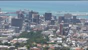
Post-apartheid South Africa represents the most ambitious and most challenging attempt at planned transformation ever undertaken in a democratic society. Apartheid cities were specifically designed to divide people based on racial difference and were marked by almost absolute segregation. The spatial engineering of apartheid also resulted in the concentration of public services and infrastructure, such as access to electricity, trash collection, schools, and paved roads in the sections of cities designated as white under the Group Areas Act. Nowhere in the world are social, economic, and racial divisions so deeply linked. Efforts to undo these inequalities have been central to the goals of the post-apartheid government at the national, provincial, and municipal levels.
With support from the National Science Foundation (grant #0527667) in the US, a team of researchers from Brown University including principal investigator Patrick Heller, Daniel Schensul, and Amy Kracker have been studying the progress that has been made in addressing these inequalities in South Africa’s three largest cities – Cape Town, Durban, and Johannesburg. This project has used data from the South African Census and municipal governments along with GIS mapping software to examine changes in racial and economic segregation as well as the extent to which access to services and infrastructure has improved for all urban residents since the end of apartheid. In addition to identifying patterns of change in inequalities, researchers at Brown have worked with research teams in South Africa to identify the forces that drive these changes by interviewing urban residents in each city as well as municipal government officials. To learn more about what we’ve found in these interviews, please click on the “Community Reports” link to the left. To learn more about the research teams click on the “Project Participants” link to the left.
An important goal of this project is to share the data that has been collected with community members, government officials, and scholars who are interested in examining changes in inequalities in South African cities and neighborhoods. The primary purpose of this website is to provide an interactive mapping tool that allows anyone who is interested to use the data we have collected to create maps to answer their own questions about how racial and economic segregation patterns may have changed or how access to public services may have changed since the end of apartheid. This system is free for public use. To learn more about what data is available and where it came from, click on the “About the Data” link to the left.