


Urban Transforma tion in South Africa
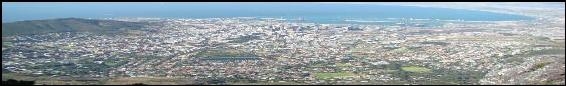
This website allows users to interactively create their own maps and explore changes in infrastructure and demographics in communities across Cape Town, Durban, and Johannesburg, South Africa.
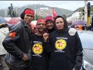
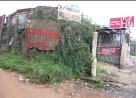
With support from the National Science Foundation (grant #0527667) in the US, Patrick Heller (the principal investigator) and Amy Kracker (PhD candidate, Department of Sociology) with help from other researchers at Brown University as well as in South Africa have been examining urban transformation in South African cities since the end of apartheid. This research uses Geographic Information Systems (GIS) data to map spatial changes in infrastructure and demographics. With this website, you can use the same GIS data to make maps and answer your own questions about urban transformation in South Africa.
To learn more about how to create maps, click on the “Getting Started” link to the left.
Note: This website functions best when viewed in Internet Explorer or Firefox.